
Project details
Website: https://projectgreeneo.eu/, https://cordis.europa.eu/project/id/101183071
Status: Ongoing
Project period: 2025–2029
Principal: EU (101183071)
Coordinating institution: NILU
Collaborators: The Royal Netherlands Meteorological Institute – KNMI (NL), Meteo France (FR), Aarhus University (DK), Meteorologisk institutt (NO), The Portuguese Institute for Sea and Atmosphere - IPMA (PT), Lobelia (ES), LGI Sustainable Innovation (FR), INRAE, France's National Research Institute for Agriculture, Food and Environment (FR), Aristotle University of Thessaloniki (GR), Umwelt Bundesamt (DE).
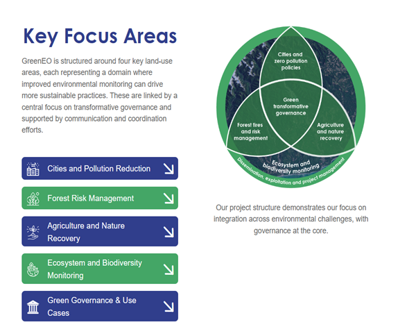
GreenEO is a Horizon Europe project that uses satellite data, environmental modelling, and artificial intelligence to support sustainable land-use practices across Europe.
As environmental pressures intensify, such as urban expansion, pollution, biodiversity loss, and climate-related risks, GreenEO aims to deliver actionable information for policymakers, land managers, and communities.
By integrating next-gen satellite data from EUMETSAT, digital technologies, atmospheric inverse models, and machine learning, GreenEO will provide decision-makers with advanced tools for land use, pollution tracking, and protect biodiversity.
The project’s mission is to:
- provide improved satellite-based environmental information to support sustainable nature protection practices
- focus on four land-use areas: cities, agricultural areas, forests and ecosystems
- facilitate the creation of practical applications such as high-resolution air quality maps, emissions tracking applications, forest fire services, and tools to monitor the health of ecosystems
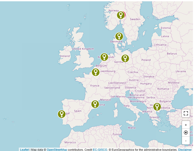
Collaborators shown in map